Flooded Areas in Thảo Điền – Roads You Should Avoid
Thảo Điền is famous for its million-dollar villas and upscale fine-dining restaurants, but it also has another well-known “specialty” that every resident eventually gets used to: flooding.
Just one heavy rain or high tide is enough to turn this “rich neighborhood” into a river, leaving even luxury cars helpless. This article will give you the latest update on the worst flooding spots in Thảo Điền and practical tips to safely navigate the area during floods.
Classic “Flood Hotspots” in Thảo Điền
Based on reports from major Vietnamese newspapers like Dân Trí and Thanh Niên, flooding in Thảo Điền is severe and highly localized. If you don’t want your car to suffer water damage, pay special attention to these roads:
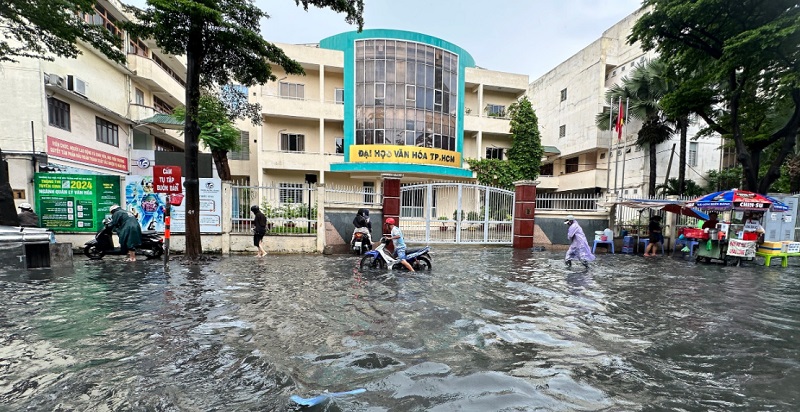
1. Đường Quốc Hương – The “Inland Sea” in front of the university
This is widely considered the worst flooding spot in the area. The section in front of the University of Culture often turns into a river after just 30 minutes of heavy rain. Water levels frequently reach 40–60 cm, easily flooding the exhaust pipes of even high-clearance vehicles.
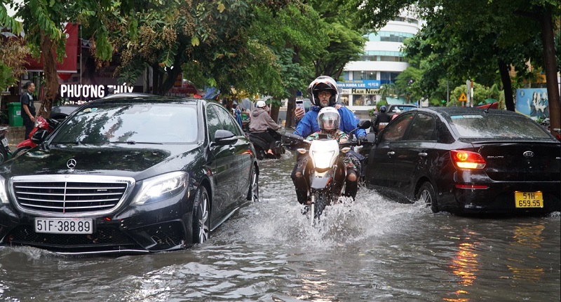
Dân Trí has documented dramatic scenes of motorbikes being knocked over by waves created by passing trucks.
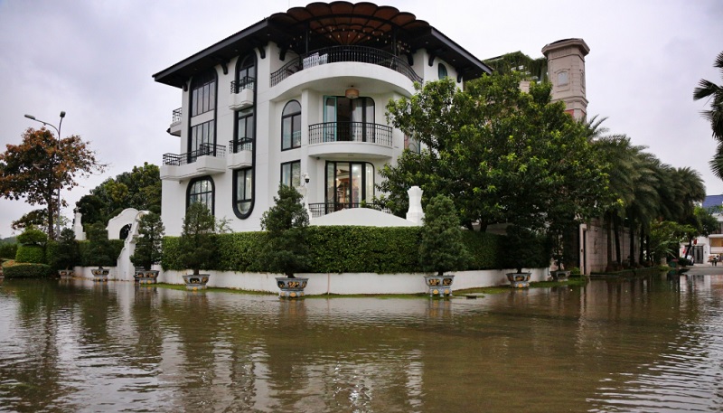
2. Đường Nguyễn Văn Hưởng – When tides invade luxury villas
This beautiful winding road lined with million-dollar villas is frequently affected by tidal surges from the Saigon River. Even on sunny days, water can quietly rise, overflow the embankments, and flood through the drainage system.
Local media (Phụ Nữ Online) has reported water entering gardens, garages, and high-end restaurants, forcing homeowners to constantly use pumps to protect their properties.
3. Đường Thái Lý – The low-lying trap
Although short, Thái Lý is one of the most problematic roads for residents. Uneven road levels create multiple water pockets. The old and outdated drainage system here often clogs with trash, causing stagnant water and unpleasant odors. Many locals have become accustomed to using flood barriers or sandbags to protect their homes.
4. Đường Tống Hữu Định & Xuân Thủy – A challenge for diners
It’s ironic that the streets with the highest concentration of Thảo Điền’s best restaurants are often flooded. When heavy rain hits, poor drainage turns these roads into obstacles. Diners frequently have to roll up their trousers and wade through water to reach the restaurants.
5. Đường Lê Văn Miến – The “lake” in the middle of the expat district
Despite being surrounded by luxury apartment projects, Lê Văn Miến has a significantly lower road level. During heavy rain combined with high tide, it easily becomes a giant pond. Water drains very slowly, paralyzing offices, spas, and making walking difficult for foreign residents.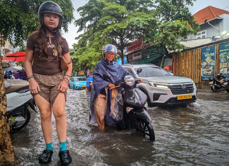
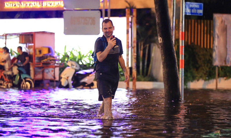
6. Đường Thảo Điền – Even the main road is not spared
The road that gives the area its name also floods regularly. It’s common to see foreigners wading through water while carrying their pets. This scene has been highlighted in Lao Động newspaper, drawing attention to the infrastructure gap in one of Saigon’s most upscale areas.
Why Does “Millionaire Row” Thảo Điền Flood So Easily?
According to Tuổi Trẻ newspaper, there are three main reasons:
- Natural geography: Thảo Điền is a low-lying area surrounded by the Saigon River in a horseshoe shape, making it highly vulnerable to tidal influences.
- Rapid urbanization: The construction of countless villas and high-rise buildings has drastically reduced natural water absorption areas. The old drainage system can no longer handle the massive volume of rainwater.
- Incomplete embankment system: Although improvement projects exist, tidal barriers and pumping stations are not always synchronized with extreme rainfall events.
Practical Tips for Surviving Floods in Thảo Điền
- Monitor tide schedules: Follow official weather forecasts and tidal calendars. High tides usually peak in the early morning or late afternoon.
- Use helpful apps: Download UDI Maps (by Ho Chi Minh City Urban Drainage Company) to check real-time flooding information before heading out.
- Know alternative routes: When Quốc Hương is flooded, detour through small alleys leading to Võ Nguyên Giáp (formerly Hà Nội Highway), which sits at a higher elevation.
- Choose high-clearance vehicles: If water rises above half the wheel, do not attempt to drive through. Pull over at a nearby café or restaurant and enjoy the slow pace of Saigon in the rain.
Flooding remains a significant downside to Thảo Điền’s infrastructure. However, the area’s undeniable charm — its cultural diversity, world-class dining, and vibrant community — still makes many people willing to “live with the floods.”
Stay smart, stay informed, and always have a safe backup plan when the rain comes.